Blog
How Classifiable Is It? (Part 1)
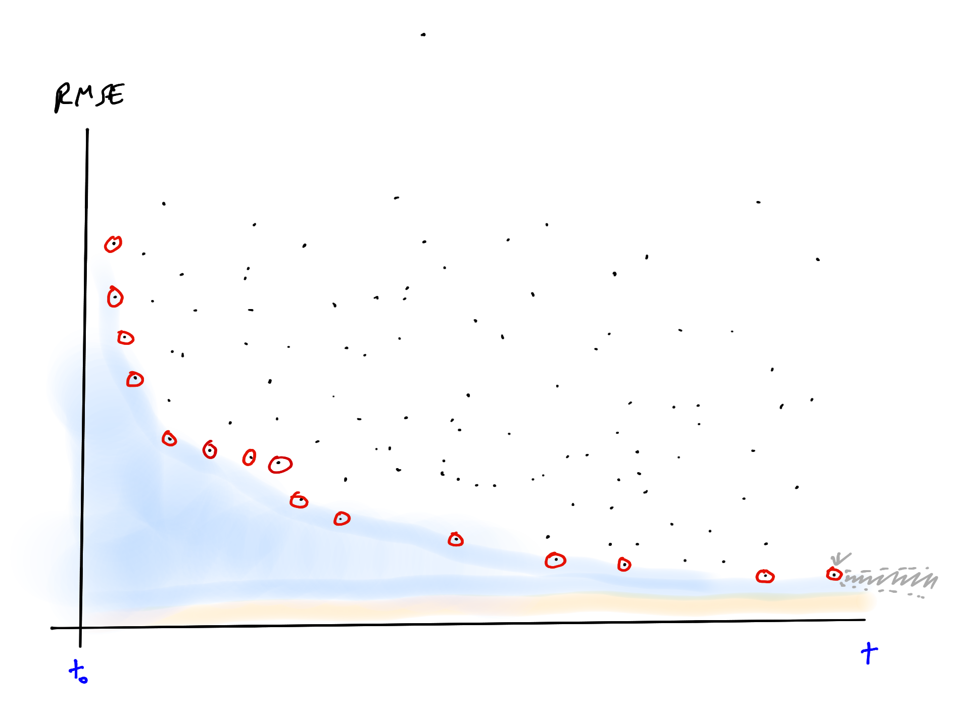
Classification algorithms give us a lower bound on how well we can distinguish categories; maybe machine learning competitions give us a way to estimate an upper bound.
Read More →
Meet the winners of the NASA Airathon: Predict Air Quality Challenge
Meet the competitors who topped the leaderboards in the NASA Airathon challenge. Their predictions of surface-level air pollution could give millions of people the information required to protect their health.
Read More →
Meet the winners of the Mars Spectrometry Challenge
Meet the minds behind the top models for identifying the chemical composition of planetary soil samples using mass spectrometry! Identifying the compounds within such samples can help scientists understand the past habitability of Mars.
Read More →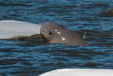
Where's Whale-Do? Data Exploration and Benchmark
How to get started with the Where's Whale-do beluga photo-identification challenge!
Read More →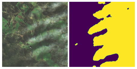
Meet the winners of the Cloud Cover Detection Challenge
Better identifying and removing clouds from satellite imagery enables a wide variety of environmental applications in disaster recovery, conservation, and more. Get to know the winning participants who advanced state-of-the-art methods in cloud detection!
Read More →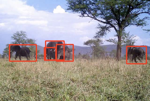
Introduction to Image Classification using Camera Trap Images
We'll show you how to get started identifying animal species from camera trap images!
Read More →
Happy April Fools' Day from DrivenData (and our pets)
Hear from the DrivenPets about the results of our competition on the pet-productivity connection for remote workers
Read More →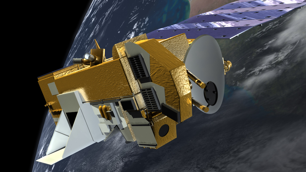
How to Estimate Surface-level NO2 using OMI Column NO2 Data
We'll show you how to preprocess HDF5 files and work with an OMI NO2 data product to estimate air quality around the world!
Read More →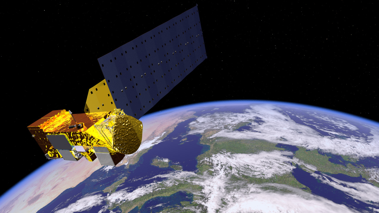
How to Predict PM2.5 using MAIAC Aerosol Optical Depth Data
We'll show you how to preprocess HDF4 files and work with a MAIAC AOD data product to estimate air quality around the world!
Read More →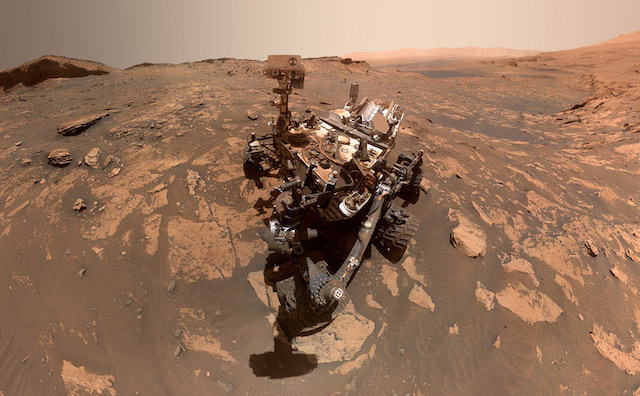
Mars Spectrometry: Detect Evidence for Past Habitability - Benchmark
In this post, we will show you how to get started on analyzing mass spectrometry data collected for Mars exploration.
Read More →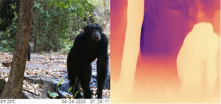
Meet the winners of the Deep Chimpact: Depth Estimation for Wildlife Conservation Challenge
Meet the minds behind the top models for measuring wildlife depth! Accurate depth estimations help ecologists track wildlife populations and protect the ecosystems that depend on them.
Read More →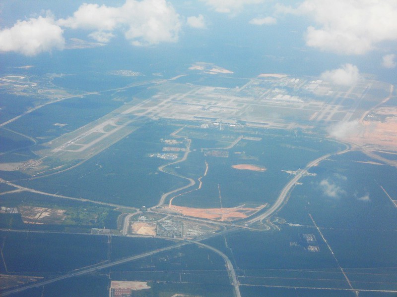
Run-way Functions: Predict Reconfigurations at US Airports - Benchmark
Start exploring how to help airports manage their runways to keep air traffic flowing.
Read More →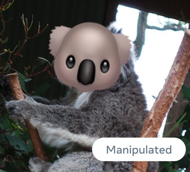
Meet the winners of the Image Similarity Challenge
Introducing the winners of the Facebook AI Image Similarity Challenge! Meet the top teams who matched manipulated images with their source images.
Read More →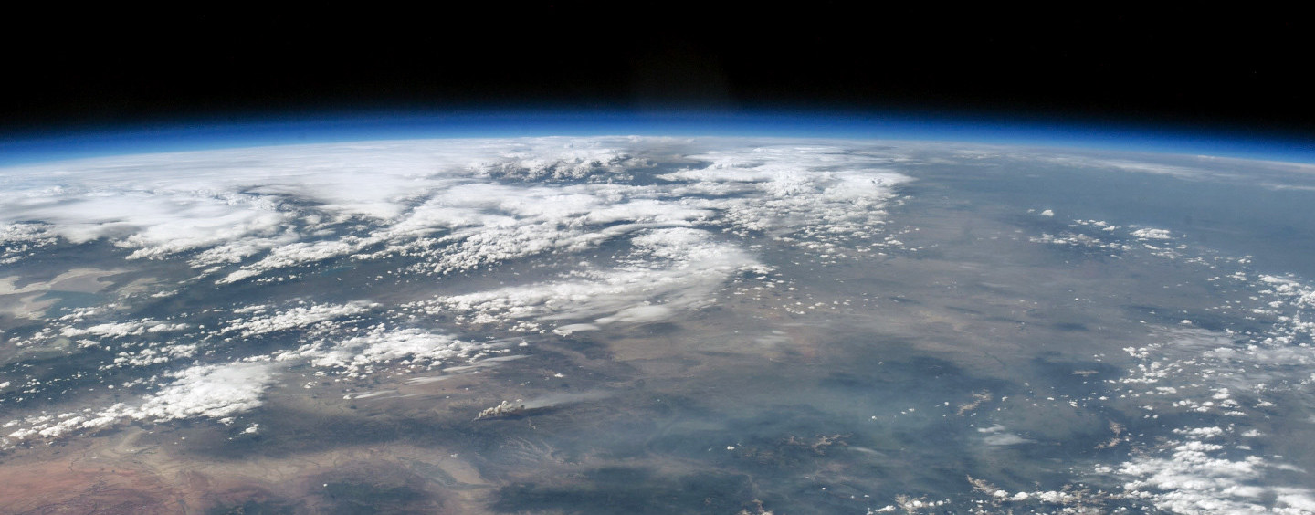
How to Use Deep Learning, PyTorch Lightning, and the Planetary Computer to Predict Cloud Cover in Satellite Imagery
We'll demonstrate how to get started predicting cloud cover in satellite imagery for our new competition!
Read More →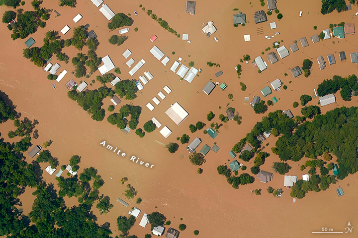
Meet the winners of STAC Overflow: Map Floodwater from Radar Imagery Challenge
Meet the winners who were best able to detect floodwater using synthetic-aperture radar (SAR) imagery! These winners developed solutions that can help to strengthen early warning systems and direct emergency relief.
Read More →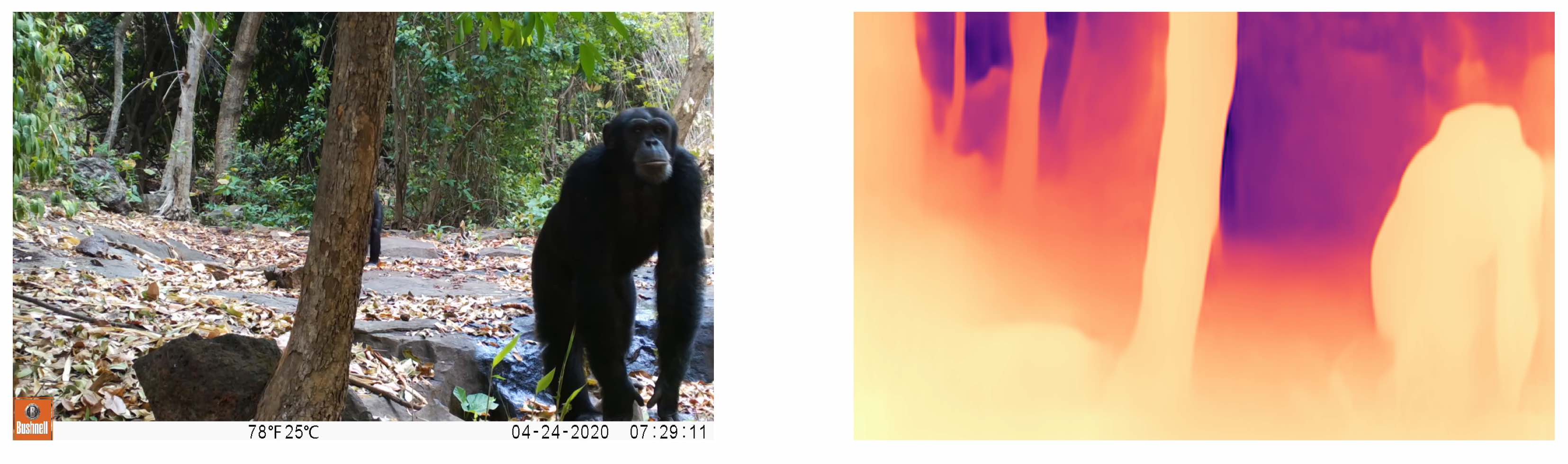
Deep Chimpact: Depth Estimation for Wildlife Conservation - Benchmark
In this guest post by MathWorks, we'll show you how to start working with camera trap videos to estimate the distance to an animal seen in the wild.
Read More →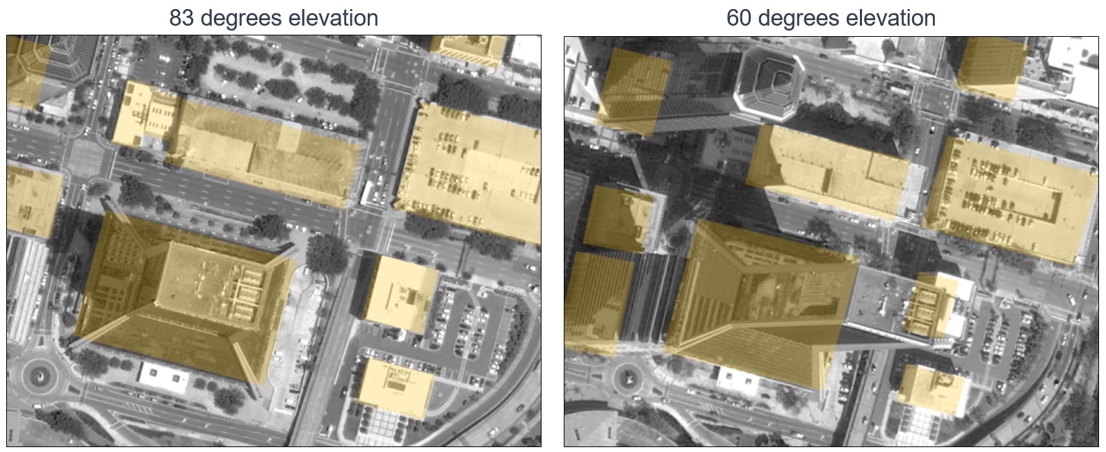
Meet the winners of the Overhead Geopose Challenge
Meet the winners with the best models for mapping oblique satellite imagery to geocentric pose! These winners helped made overhead imagery more useful for time-sensitive applications like emergency response.
Read More →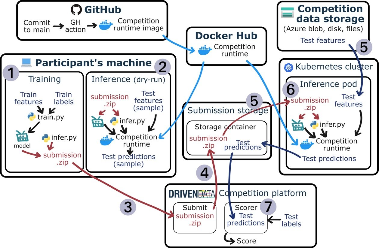
A peek inside DrivenData's code execution competitions
Code execution competitions allow participants to run their code on unseen test sets and have their best scores displayed on a live leaderboard. Read on to learn more about the what, why, and how of DrivenData code execution competitions!
Read More →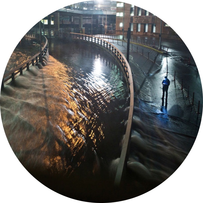
How to Map Floodwater from Radar Imagery using Semantic Segmentation - Benchmark
We'll show you how to tune a U-Net model to measure flood extent using Sentinel-1 synthetic-aperture radar imagery.
Read More →
Facebook AI Image Similarity Challenge - Getting Started
In this post, we will introduce the Facebook AI Image Similarity Challenge and highlight some resources to help you get started.
Read More →